Housing. Land and Property • Iraq
2023 - 2024
Photo: UN Habitat Iraq
Facility to Support Policy Dialogue and Technical Assistance in Iraq
2023- 2024. EUD Iraq / DAI Global
Under the umbrella of the EU-funded "Facility to Support Policy Dialogue and Technical Assistance in Iraq", I led the inception phase of a Political Economy Analysis of HLP management reform in Federal Iraq and the Kurdistan Region.
This involved designing the analytical framework and work plan, mapping key stakeholders and regulatory structures, and shaping evidence-based recommendations to inform EU engagement in housing, land, property rights, and public works, with a focus on social and affordable housing solutions for Internally Displaced Persons (IDPs).
Remote Damage Assessment • Ukraine
2023
Photo: Jade Koroliuk on Unsplash
Strengthening Urban Resilience in Utility Infrastructure and Housing
2023
In this short-term assignment I developed a structured market overview of Ukrainian GIS and remote sensing service providers capable of supporting land and urban asset management through satellite, aerial, and drone-based damage assessment.
Based on desk research and interviews, companies and experts with practical experience in applying GIS, machine learning, and spatial data analysis to map, quantify, and classify war-related impacts on buildings, land parcels, and critical urban infrastructure were identified as an input for a corresponding tender.
Housing. Land and Property •Syria
2018 - 2022
Photo: Norwegian Refugee Council - NRC
Safeguarding the Claims of Syrian Refugees and Internally Displaced People to Housing, Land and Properties (HLP)
2018 - 2022. GIZ
Director of a technical assistance project securing HLP rights for Syrian refugees and IDPs displaced by conflict.
The project focused on awareness-raising, legal protection, documentation of HLP rights, policy dialogue, and housing restitution and reconstruction studies. I managed technical teams in Gaziantep, Turkey, and Beirut, Lebanon, and grant agreements with UN-HABITAT, the International Organization for Migration (IOM) and the Norwegian Refugee Council (NRC).
Informal Settlements Observatory • Syria
2018 - 2022
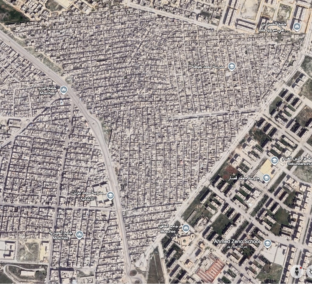
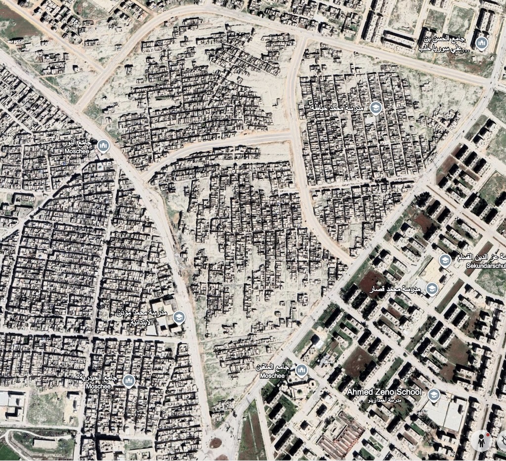
The case of Al Haydariah in Aleppo: March 2016 and March 2021
Safeguarding the Claims of Syrian Refugees and Internally Displaced People to Housing, Land and Properties (HLP)
2018 - 2022 GIZ
As Director of the HLP project, I led the development of an Informal Settlements Observatory to document destruction, displacement, and risks to HLP rights in informal settlements in Syrian cities particularly in Damascus and Aleppo, with a focus on vulnerable populations lacking formal tenure.
The Observatory approach combined GIS-based spatial analysis, satellite imagery, media monitoring, and case studies to build an evidence base for advocacy, supporting Syrian civil society, media, and international stakeholders in policy dialogue on return, restitution, and reconstruction.
Historic Centre Observatory • Romania
2001 - 2002
Sustainable Renewal of the Historic City Centre of Sibiu / Hermannstadt
2001 - 2002 German Technical Cooperation
In backstopping assignments for the project, I led the development of the concept and stepwise implementation framework for a GIS-based Historic City Observation System (HICOS). This involved coordination with the municipality, cadastral and land registry offices, IT services, and private GIS providers to align roles, standards, and technical architecture.
The HICOS concept integrated spatial data, cadastral records, heritage inventories, and socio-economic and infrastructure information into a modular monitoring system to inform decision-making for heritage conservation and land management in the historic core.